An unsuccessful hike to Davis Lake in Mission
Recently, Tanja and I attempted to hike to Davis Lake in Mission. And we failed. But that’s ok. Because it reminded me that adventures teach you about serendipity. And about preparation. Let me start at the beginning.
First of all, it’s Jelger here. Tanja’s pretty swamped into editing some photos from shoots she recently undertook on her own. And although usually I carry the post-production workload on my own, she’s now immersing herself in the exciting world of color and contrast correction. So I decided to grab the proverbial microphone of our blog and tell you the story about our unsuccessful hike to Davis Lake.
Recently I’d bought the Backroad Map Book of Vancouver and the Lower Mainland because I’d like to explore lesser-known hikes. So two weeks ago, I started poring over the maps and stumbled on a tiny provincial park in Mission, BC, named Davis Lake Provincial Park. After confirming its existence on the official website, we decided to let spontaneity get the upper hand despite the late time in the day and drove to the supposed location of the lake. Bad decision. Or not bad, just not the smartest.
For those of you who have the Backroad Map Book, you’ll know that the maps are not the most detailed. But I figured Google Maps would fill in the gaps that the book left. I mean, how hard can it be. Right? Harder than you’d think!
We got to the vicinity of the lake and drove for a few kilometers along the unpaved road. Except, no lake, no signs, nothing at all. According to the GPS system and Google Maps, we’d already passed the lake. Strange, you’d expect some kind of clue for an official Provincial Park. So we drove the same way back. Maybe we’d passed the entrance. Nope. Nothing. Meanwhile, we’d ventured into territory without cell phone reception, which eliminated online sleuthing for clues to the mysterious entrance. So instead we asked a few teenagers in off-road vehicles, who hadn’t even heard of the lake/provincial park. Frustrated, we caved and drove back until our phones could serve us the help of a few bloggers.
Armed with hints and coordinates of where the entrance was supposedly hidden we returned to the spot we’d meanwhile passed not once, but twice! We parked and talked with a few helpful hikers, who unfortunately only could confirm that according to their maps the lake should be awaiting us behind the forest. “Success!” I remember thinking, even though meanwhile the time had advanced to an hour before sunset. But according to the map, the lake was no more than 15 minutes away.
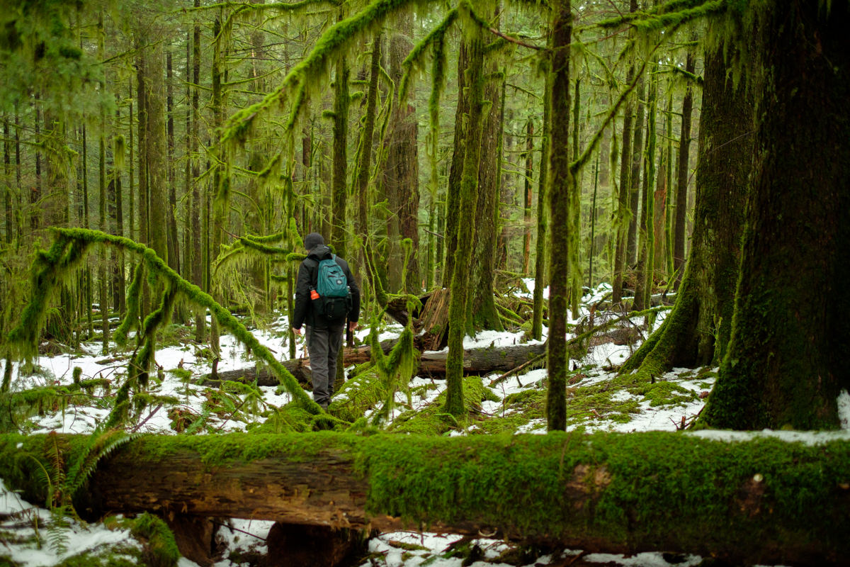
We loaded our survival kit from the car and ventured into the dense forest. It’d be our first true hike off the beaten path. Hell, there was no path! But I was prepared. Every 50 yards or so, I tied some flagging tape to a clearly visible spot, checked my compass and pushed forward. Except… every single tree looked like its neighbor! And even though I could still catch a glimpse of our car in the distance, as soon as I’d turn around I lost all track of direction and location. It felt… hard, and somewhat intimidating. But onwards we went. Until we hit a pretty big gully. Too big to breeze by, and no way around it.
We stopped, and I felt quite frustrated. I had imagined the process to be a lot easier, to be honest. And instead, I felt like an unprepared idiot. Tanja suggested we do the wise thing and return to our car (which was a ridiculous 10 or so minutes away). Not in the least because the sun was about to set. After much fretting, I concurred. But it took me a while to gain perspective on my situation.
Here’s the deal. Born and raised in Belgium, I never experienced true, uncharted wilderness. Sure there are forests in Belgium, but I always joke about them that it’s pretty much impossible to get lost in them. Just keep walking in a straight line for a few hours, and sooner or later you’ll end up in a village. It makes it hard to truly gauge the inherent risk of BC’s vast nature. Sure, I’ve heard and read about it, but never experienced it as such. So far, Tanja and I have pretty much always stuck to trail hiking. But now, with my newfound desire for more off-the-beaten-path adventuring, I’ll have to step up my game, by learning to actually use that compass and get some detailed topographic maps of the territory. I’m already working on improving my skills in these areas.
As for Davis Lake Provincial Park. More online research taught me that despite its official status, the whole thing suffers from severe administrative neglect. Vandals have removed the signs, and the entrance trail is overgrown, making it virtually impossible to spot from the road unless you’ve got exact coordinates. Which I do now.
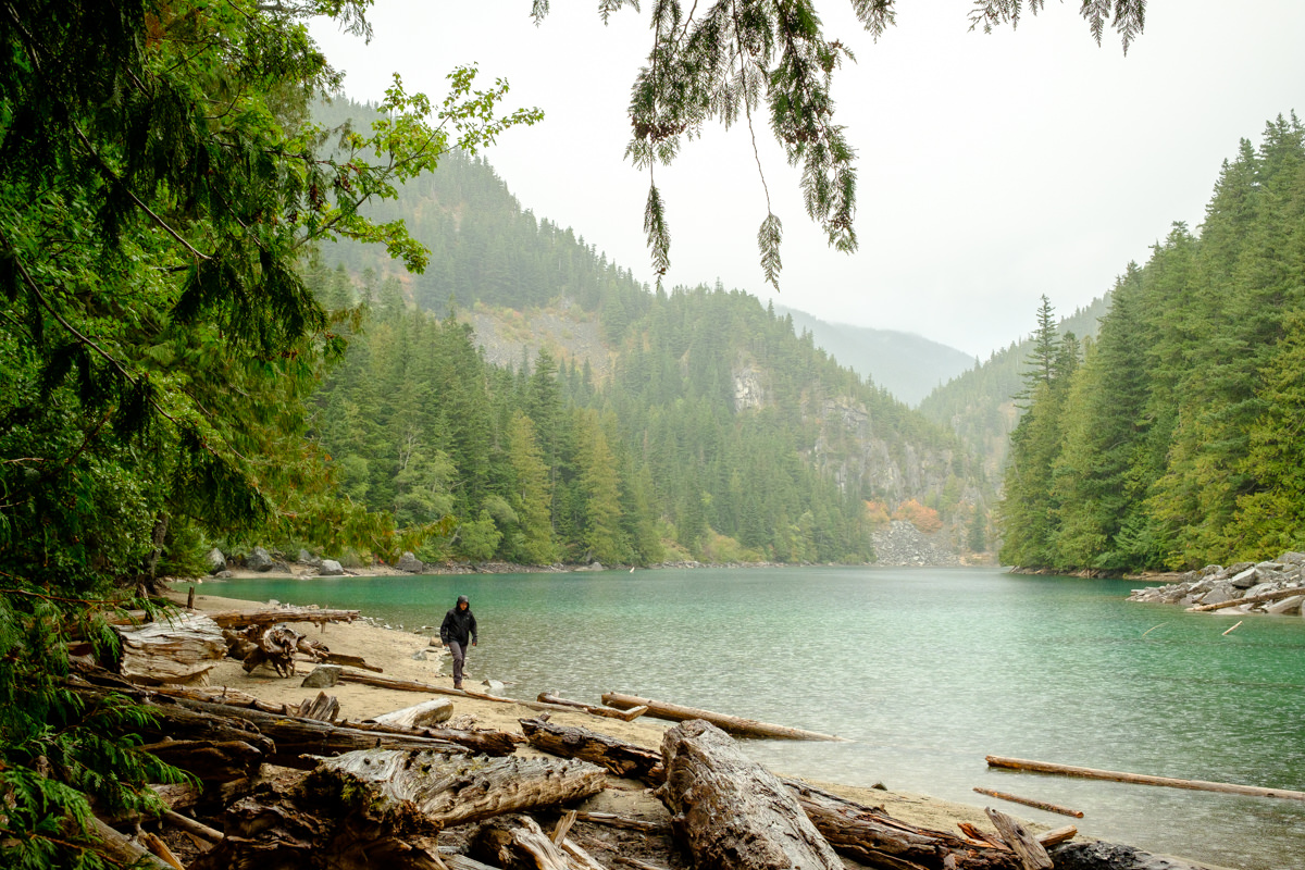
Before leaving the area, we goofed around on a nearby clearing and took some photos of each other. But we’ll be back for the actual lake. To be continued.


Hi! Would you please share the exact coordinates?
You mention “ ….making it virtually impossible to spot from the road unless you’ve got exact coordinates. Which I do now.”
uh oh… it’s been na while and this shows us we need a better way to keep track of past hikes, because I definitely don’t have the coordinates anymore. That said, it’s pretty much right besides a small bridge over the water. (I hope this is helpful at all… ) there’s space for parking on the left and the trail starts in the forest on the left too.